Zeusch Aviation aircraft PH-ZAZ deployable for Aerial Mapping and Aerial Survey
Lelystad, The Netherlands/ September 8, 2020 – Zeusch Aviation, the Netherlands-based aerial services provider, hereby wishes to present an announcement for periodic availability of one of their aircraft. Aircraft can be deployed for Aerial Surveillance and Aerial Mapping.
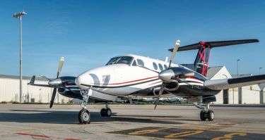
Zeusch operates a King Air fleet which is used for aerial surveillance, aerial mapping flights. broadcast relay services, medevac and transplant flights.
The aircraft has been equipped with a brand new AVCON removable mapping window in the aircraft belly which enabled aerial mapping / survey capabilities. The modifications support the company’s focus on delivering high-standard mapping and surveillance services and serve to enhance the aircraft’s operational value.
The window increases terrestrial visibility to ensure accurate data collection to support detailed map creation. It has undergone a complete overhaul of both engines in preparation for its expanded offering. The aircraft is now available for mapping and surveillance missions for private individuals, governmental associations and corporations who want to establish the geospatial baseline of an aerea’s topography, natural landscape, built environment and more.
The aircraft, PH-ZAZ, is deployable as from September up and until December 2020.
Contact us when you are interested.
About Zeusch Aviation:
Zeusch Aviation, based at Lelystad Airport (EHLE) in The Netherlands, provides a wide variety of aerial support using its King Air aircraft including aerial mapping flights, aerial surveillance, broadcast relay services, medevac, and transplant flights.
https://zeusch.com/
Media Contact:
Martha Hiddink
Sales & Marketing Manager
Zeusch Aviation BV
T: +31 6 40151960
E: m.hiddink@zeusch.com